Free Shapefiles of Countries of the World (2)
Note: read also part 3 and part 4 of this blog.
After input on my recent blog (thanks!) and after that I find two more, another post about this.
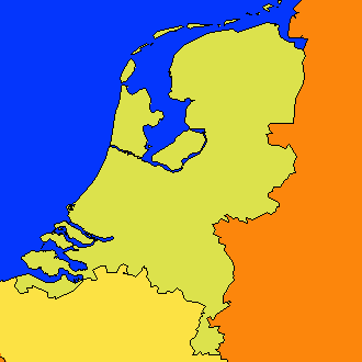
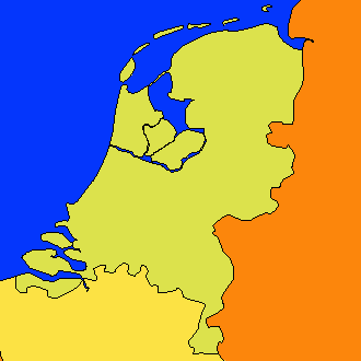
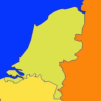
To judge the quality of the dataset, I use my own country (the Netherlands) as the primary measure. I've a mental map about my country, and know how it should look like. In many of the found datasets it looks completely destroyed. Therefore, personally I would discard them at once. Other datasets quite precisely depict my country. Maybe it is not only because I live here, but also about the topography: it has a large inner lake, it has some islands, and it has a distinctive shape.
So here the previous datasets, and four more, and some variations, come again...
 |
|

|
|
 |
|
 |
|
 |
|
 |
|
 |
|
 |
|
 |
|
 |
|
 |
|
 |
|
| (10). I wanted to do VMAP0
/ VMAP1 here. However, my little research concerns a (one) shapefile of
countries of the world. Vmap0 is great but to let users figure out all
the detailed files and merge them for four parts of the world is not the purpose I started the research with... so no picture here. Thanks for the tip anyway. |
|
 |
|
Based on this series, (3) would probably be the best choice, though a bit heavily detailed. Surprisingly, it is created in the Netherlands... So we cannot judge its quality from this series. Furthermore, (7) would be a reasonable choice, but we saw in the previous blog that (7) is wrong with respect to the Caspian sea. The new dataset (9b) is looking quite good to me for a map on world scale, but alas it misses an important lake. We might see more in another blog, for example showing the countries around the Caspian sea, or the countries in the former republic of Yugoslavia.
Conclusion
I think a good and free shapefile of the world is still welcome.


have a look at http://epp.eurostat.ec.europa.eu/portal/page/portal/gisco/popups/references/administrative_units_statistical_units_1
ReplyDeletethere are vector data sets of the world for different scales.
Helmut
Thanks! 255 countries, seems like a full byte ;-) I'll come back to this.
ReplyDeleteYou can find the polbnda (political boundaries) layer of VMAP0 in shapefile format at http://efele.net/maps/.
ReplyDeleteThanks! I found a country map (fips) here indeed:
ReplyDeletehttp://efele.net/maps/fips-10/map
and I will process it (polbnda contains subdivisions, but is the base for fips).
Note that VMAP is still not included here but it is not forgotten, it will come.
ReplyDelete